This article may contain affiliate/compensated links. For full information, please see our disclaimer here.
Wellington is a fantastic city to visit while in New Zealand, it is a bustling city with plenty to keep you entertained. However, when in Wellington I have found getting off the beaten track a little can be an extremely good way to see this city in all its beauty. Whether you are looking for some new Wellington walks to get the blood pumping at the weekend, or just simply looking for a way to get away from the shipload of tourists that descend on the city everyday, you can find all the information you need right here for some of the best walks you’re likely to discover in Wellington. This list is based on over 2 months of walking many of Wellington’s best trails and tracks; I hope you enjoy!
Best Wellington Walks
1. Skyline Walkway
- Distance: 13.5km
- Time To Complete: 4-5 hours depending on fitness
- Difficulty: Medium/Challenging
- Start and Finish: End of Carmichael Street in Johnsonville and 125 Makara Rd, Karori, Wellington
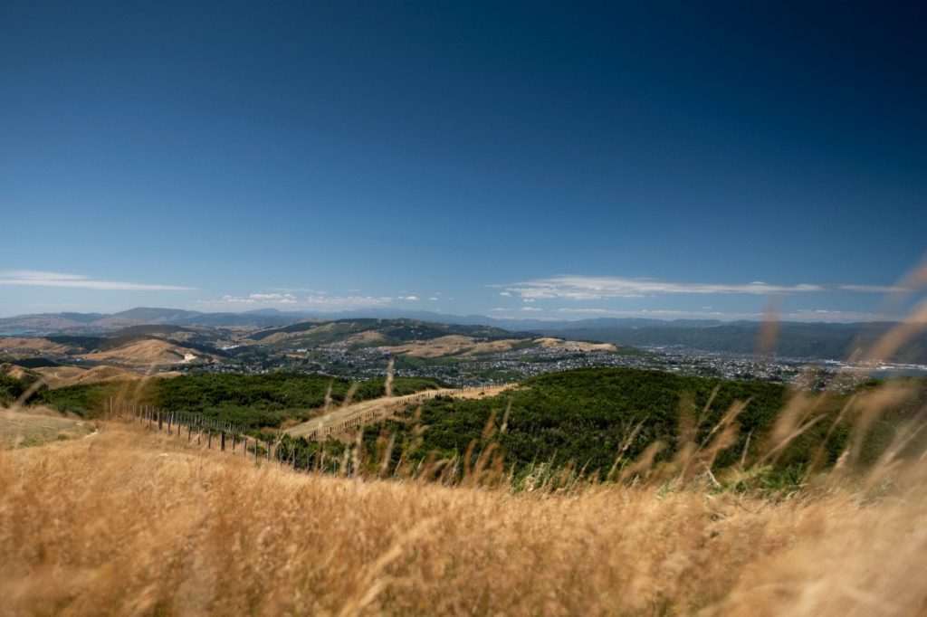
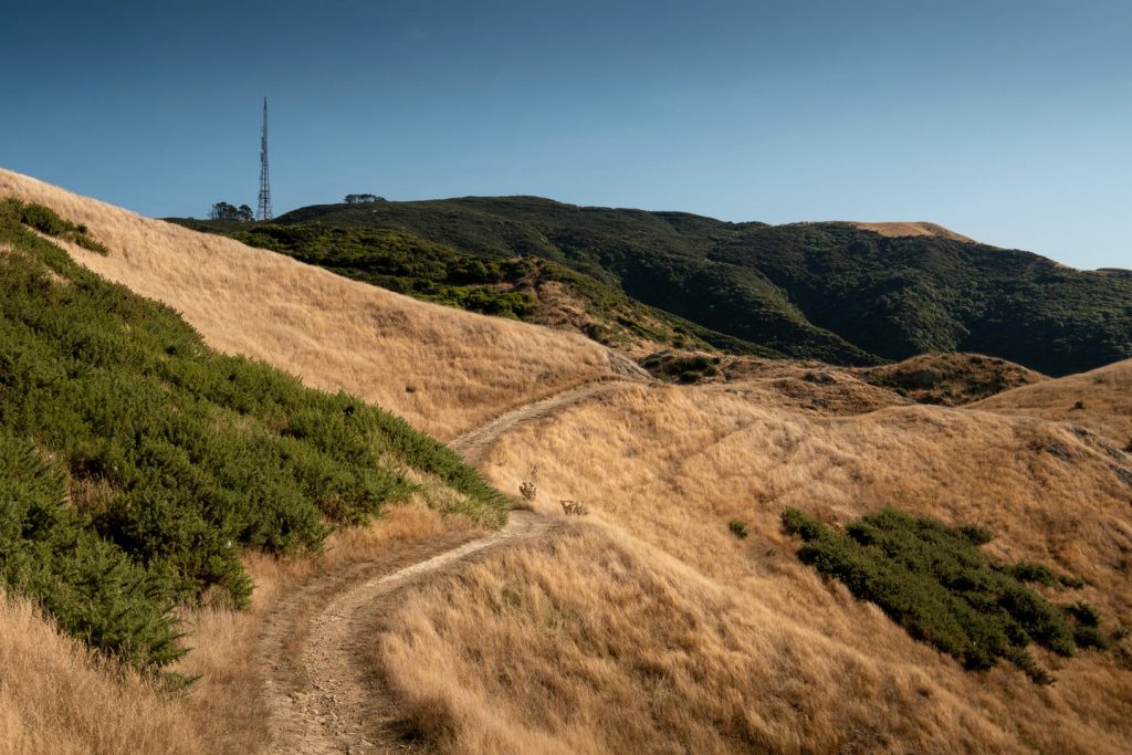
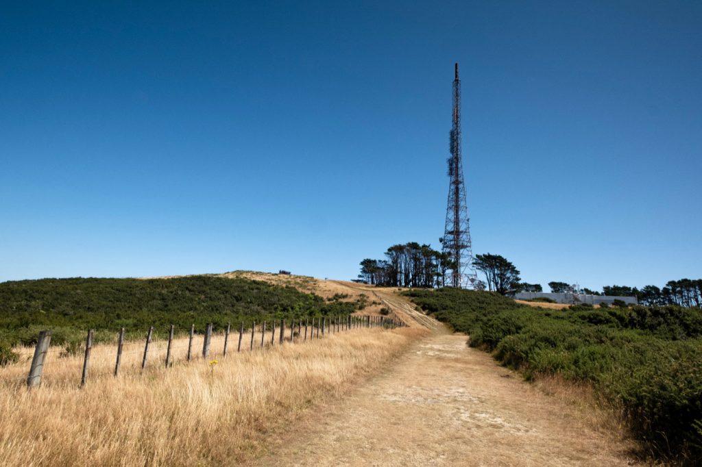
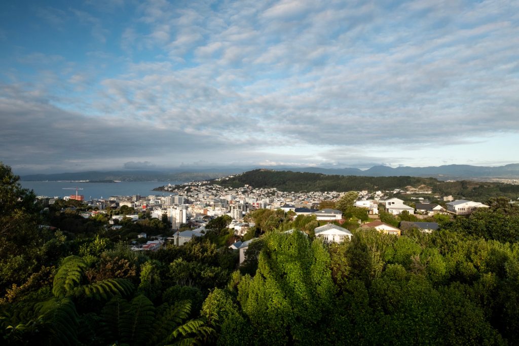
The Skyline Walkway in my opinion is one of the best Wellington walks you are likely to find. If you have a full or even half day available for a walk this would be the one I would recommend. At 13.5km it is a fairly challenging route so you will need a reasonable level of fitness in order to complete the entire distance. If the full distance of the walk sounds like it might be a little bit too much you can just complete certain sections. For instance, the first part of the walk starting from Johnsonville that travels to Mt Kaukau is very beautiful, it has views that look over the city and harbour of Wellington.
Throughout the walk you will be treated to insane views of both the city and scenery that Wellington has to offer. This walk starts/finishes in Johnsonville at the end of Carmichael Street and finishes/starts in Karori at 125 Makara Road. If you would like more information on the Skyline Walkway I have written an in-depth article that you can find here.
2. Northern Walkway
- Distance: 16km
- Time To Complete: 4-5 hours depending on fitness
- Difficulty: Medium/Challenging
- Start and Finish: Raroa train station, Johnsonville and Upland Road next to the top of the cable car in Wellington Botanic Gardens. The address is 1A Upland Rd, Kelburn, Wellington
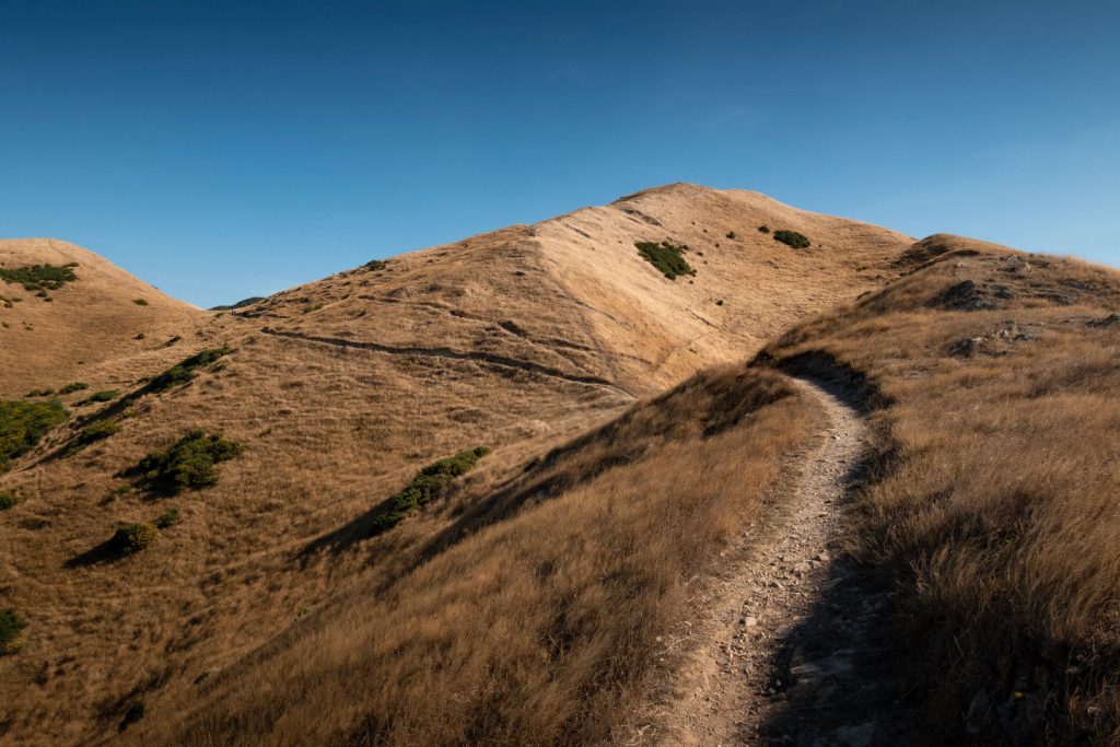
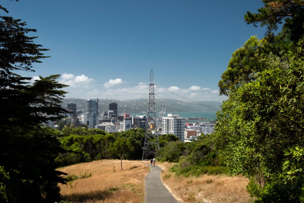
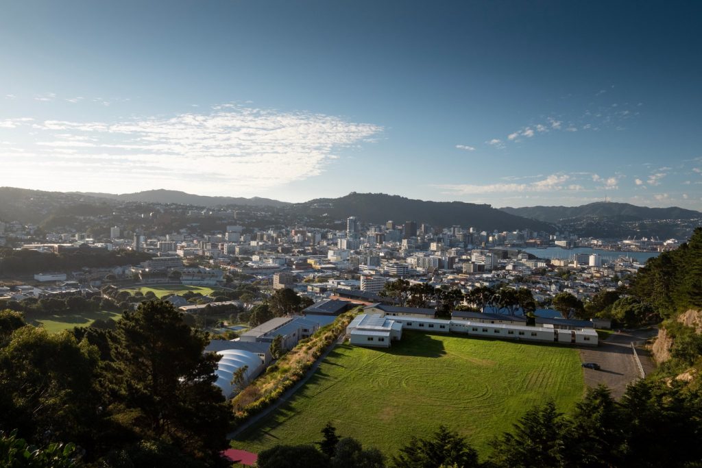
The Northern Walkway is another great Wellington walk that travels between Johnsonville and the city centre similar to the Skyline Walkway. The walk itself is slightly challenging but is well worth the effort as you get to travel through some pretty incredible landscapes. With a total distance of 16KM you will need a reasonable level of fitness to complete the entire journey. Like a lot of the walks in Wellington if you don’t fancy tackling the whole route you are able to walk various smaller sections of it.
On this walk you will be rewarded with trips through Johnsonville Park and Khandallah Park where you will climb to the top of Mt Kaukau. You will get to walk through Wadestown which has some extremely scenic forestry areas. The walk comes to a close as you travel through the Wellington Botanic Gardens and ends at the top of the cable car for some great city views. Throughout the walk you get some of the best vistas of the city and harbour that I have seen in Wellington especially as you are travelling through Wadestown. If you wanted to find out more about the Northern Walkway click here.
3. Escarpment Track
- Distance: 9.1km
- Time to Complete: 3-4 Hours
- Difficulty: Easy/Medium
- Start and Finish: Paekakariki and Pukerua Bay
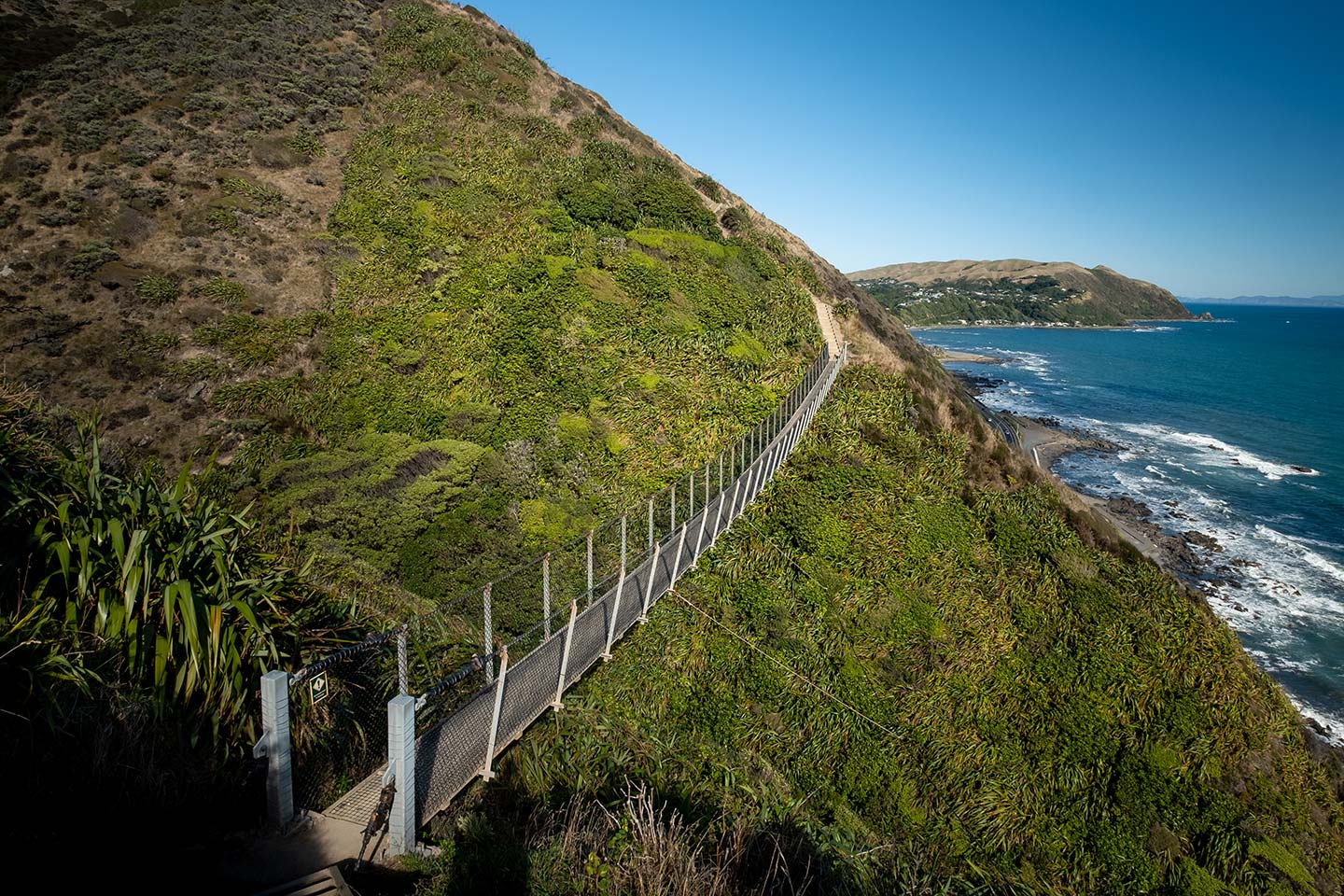
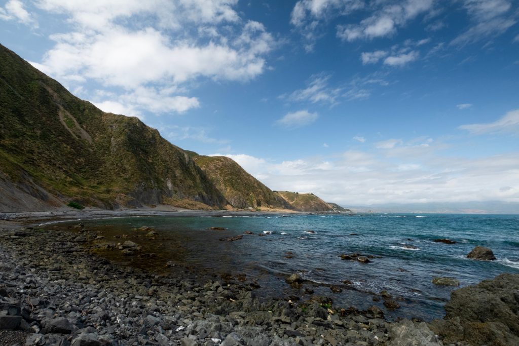
The Escarpment Track is a little further outside of the city than some of the other Wellington walks, it is however possibly one of the best in the local area. The track will have you walking alongside the Tasman Sea where you will be able to enjoy the panoramic views of the Kāpiti coastline. During your walk along the trail you will encounter over 1000 steps and two interesting swing bridges which are the highlight of the entire walk.
The Escarpment Track is actually part of the Te Araroa trail. This is the track that runs from Cape Reinga at the top of the North Island and ends in Bluff at the bottom of the South Island. The track is popular among locals and visitors to Wellington and during the summer you can expect to encounter lots of people enjoying the trail.
The track is accessible by car or train as the start and finish are close to stops on the Kāpiti line train service. It takes just 45 minutes to reach the start of the track from Wellington train station. If you want to learn more about this amazing walk you can check out my guide to the Escarpment Track here.
4. Red Rocks Walkway
- Distance: 2.7km one way
- Time To Complete: 40 minutes one way
- Difficulty: Easy
- Start and Finish: Te Kopahou Visitor Centre, Owhiro Bay
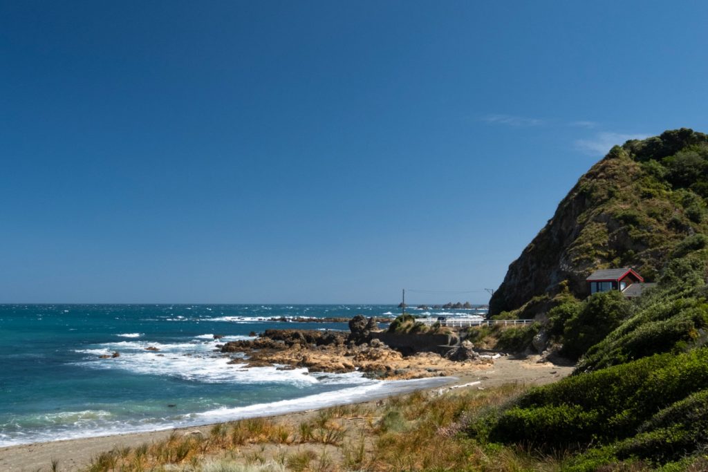
The Red Rocks Walkway is a beautiful coastal walk on the southern coast of Wellington near Owhiro Bay. It’s one of the more family friendly Wellington walks on the list as the total distance is 5.4km and travels down a very flat 4WD track which makes the walk extremely easy. As you can probably guess from the name of the walk, towards the end of the track there are lots of large red coloured rocks that are a pretty interesting addition to the rugged coastline. The red rocks make the walk quite unique, but throughout the walk you are surrounded by all the beauty that the Wellington coastline has to offer.
During the winter months it is not uncommon to see fur seals out and about which is quite a sight to see. There is parking located and the start of the walk just outside the visitor centre, or if you are looking to travel to the walk via public transport you can search your route on the Metlink website.
5. City to Sea Walkway
- Distance: 14km
- Time To Complete: 4-5 hours depending on distance
- Difficulty: Medium/Challenging
- Start and Finish: On the corner of Bolton Street and Mowbray Street, and Shorland Park in Island Bay
The City to Sea Walkway is one of the Wellington walks that connects the city centre and Island Bay together. On the route you will travel through the Botanic Gardens, the grounds of Victoria University, Aro Valley, the town belt and many parks and reserves, while taking in the spectacular views all over Wellington. The route is slightly challenging, especially if you are not a regular walker as there are a fair few uphill sections. Like a lot of the other tracks though you can choose to walk various sections without walking the entire route.
This walk has some great views of the city at the starting point within the CBD, and also along the majority of the route. My favourite part though was towards the start/finishing point in Island bay as you have some spectacular views over the bay and down the entire coastline. If you’d like to find out more about the City to Sea Walkway I have written an article that details everything that you’ll need to know.
6. Wellington Botanic Gardens
- Distance: You can decide this
- Time To Complete: 30 minutes +
- Difficulty: Easy
- Start and Finish: You can decide where you would like to start and finish from the many entrances
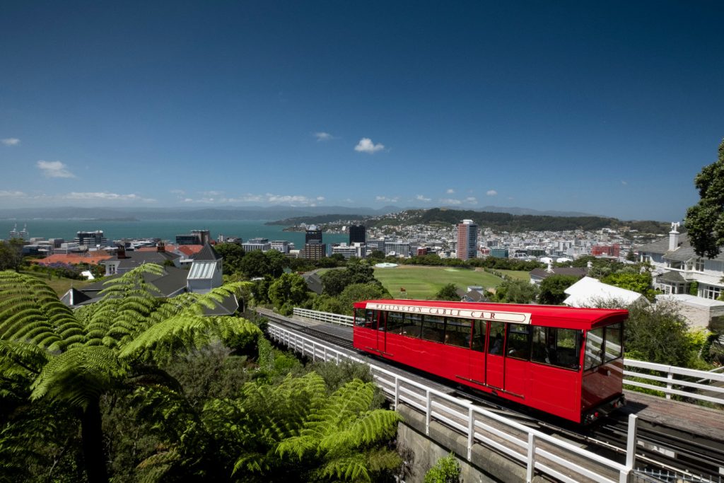
The Wellington Botanic Gardens offers walks to suit everyone. Whether you are looking for something new to do with the family at the weekend, or you’re just in the city for the weekend and would like to get outside and enjoy the sun, the gardens are full of colourful floral displays, native forest and beautiful plant collections throughout. There are many routes through the gardens so you are free to wander around for as long as you’d like, there is plenty to see so you might find it takes a while. A lot of the paths in the gardens form circuits so if you’d like you can do a loop of the garden. There are a few self-guided walks; you can find information for these from the Treehouse Visitor Centre located within the gardens.
One of my favourite parts of the gardens is at the top of the cable car where you have some stunning views over Wellington city. The garden has many entrances including from the cable car, Bolton Street Cemetery and the main entrance on Glenmore Street. If you’d like to find out more information on the Botanic Gardens you can find it on the Wellington City Council Website.
7. Southern Walkway
- Distance: 11km
- Time To Complete: 3-4 hours depending on fitness
- Difficulty: Easy/Medium
- Start and Finish: Where Oriental Parade meets Carlton Gore Road and finishes in Shorland Park in Island Bay
The Southern Walkway is the second walk on the list that connects the city centre and Island Bay on the south side of Wellington together. Although it is a relatively long distance walk at 11km it is certainly not too challenging. The walk itself has a few uphill climbs but the majority of the walk is flat and pretty easy throughout. If you’re looking for a walk that has incredible views over the city and harbour this would be a good one to pick.
As well as the views over the city the majority of the walk travels through the stunning town belt where you will find peace and quiet in the shaded forests. To finish the walk you travel along the rugged southern coastline, past the many bays until you reach the finale in Shorland Park. This walk is great if you would like to see the various scenery that Wellington has to offer, from the busy city centre all the way to the tranquil coastal bays. If you’d like to find out more about the Southern Walkway you can read more here.
8. Maitu/Somes Island Walks
- Distance: You can decide this
- Time to Complete: 1-2 Hours
- Difficulty: Easy
- Start and Finish: Maitu/Somes Island Wharf

There are plenty of great walking tracks on the mainland of New Zealand but did you know there are also some great tracks on some of the surrounding islands? Maitu/Somes Island, which is situated within the Wellington harbour, has some great walking tracks including one which will take you around the entire island.
The Maitu/Somes Island loop track is an extremely interesting walk which will allow you to take in the 360 degree views of Wellington Harbour. Along the trail you will encounter amazing native wildlife, a lighthouse and historic buildings which give you an insight into the rich and diverse history of this island.
If you are looking for some walks in Wellington which are more family friendly, I’d recommend you check out Maitu/Somes Island. The tracks around the island are very easy to walk and there is plenty to keep the kids interested.
You can access the island using the East by West Ferry. You can catch the ferry from Days Bay or Queens Wharf in Wellington city. If you would like to learn more about walks on Maitu/Somes Island you can check out my day-tripping guide here.
9. Polhill Reserve Loop
- Distance: 7.3km
- Time To Complete: 2 hours
- Difficulty: Medium
- Start and Finish: Just before Holloway Road on Aro Street. Outside Polhill Reserve.
This loop track that circles Polhill Reserve is a relatively easy walk that travels a total of 7.3km. So if you’re looking for an easy track that has a fairly long distance this walk would be a good choice. The walk travels through a variety of scenery including shaded native bush and more open areas where you will get some great views of the city and harbour. The route is very easy to navigate as long as you follow the map and directions that you can download from the Wellington City Council Website.
10. Mount Victoria Loop
- Distance: 4.7km
- Time To Complete: 2 hours
- Difficulty: Medium
- Start and Finish: Charles Plimmer Park at the top of Majoribanks Street
The Mount Victoria Loop is a good option if you’re looking for a relatively short walk that will take about 2 hours to complete. The walk follows a relatively easy route so is suitable for people with an average level of fitness. On the walk you will follow and join three different walkways, these are the Hataitai to City Walkway, Southern Walkway and Newtown to Hataitai Walkway. On the walk you will get some great views and vistas over the city centre, harbour, Newtown and Hataitai. Some of the best sights on the walk can be found when you reach the top of Mount Alfred after about 30 minutes of walking. You can find a map and directions for the walk on the Wellington City Council Website.
Pin It!